
Doña Ana County Previous Residents Sources
Past residents are not supplied by one public county list. The current parcel record establishes the present assessment account, legal geography, and owner or deed-holder clues. Recorded instruments can then document a title chain. Maps date a block or building context, while directories and census schedules offer a dated published household association when the needed volume or schedule exists. The Clerk’s landing page does not publish an online index or image cutoff, and the local library’s inspected public pages do not publish a complete directory run. Those gaps should remain visible in an address timeline.
| Source | Years it covers | Where held | What it can show |
|---|---|---|---|
| County assessment parcel data | 2025 assessment snapshot; some 2026 changes processed from 2025 recordings | County GIS / Assessor | Current parcel and assessment fields, not historical occupancy. |
| County Clerk recorded instruments | Public landing page does not state coverage | Clerk search, counter, or document request | Deed chain and recording references; verify online limits with the Clerk. |
| Las Cruces Sanborn map | July 1921, 12 sheets | Library of Congress | Building, street, and block configuration, not occupants. |
| Digital Sanborn database | New Mexico database 1867–1970; town and year vary | Las Cruces Public Libraries | Historic map evidence only. |
| City, telephone, or reverse directories | Exact local runs not confirmed in inspected sources | Branigan Library or NMSU inquiry | Published address association if the actual volume has it. |
| Federal census | Through 1950 released as of 2026 | National Archives and library genealogy resources | Household facts at a census date under the 72-year rule. |
Start with the parcel and deed chain when the question is ownership. Start with a catalog and volume check when the question is who lived at an address in a particular historic period. A known date helps choose the right source before any name is searched.
Doña Ana County Previous Residents Parcels
The present parcel is the practical first anchor for a backward search. The County service makes OWNERNAME, DEEDHOLDER, SITUSADDRS, mailing address fields, account and parcel number, lot, block, subdivision, township, range, section, and TRS available as assessment attributes. Copy both the situs and the mailing address but do not treat tax mail as proof that a person lived at the property. The legal-description fields are the durable bridge from a current address to an older plat, deed, or book reference.
The County GIS services page is the source shown here for historical imagery and related map resources.
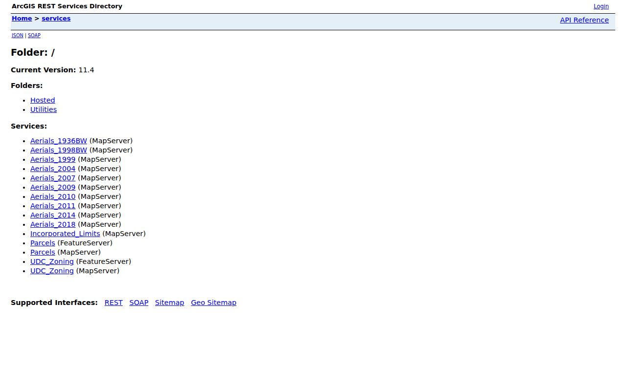
The County GIS services include historic imagery layers for 1936, 1998, 1999, 2004, 2007, 2009–11, 2014, and 2018. An image can support a construction or physical-change question when paired with a date and other records. It cannot identify a former household, confirm a boundary, or replace the Clerk’s recorded source.
Note: Record an account, parcel, and legal description before working backward, because a street label can change or be incomplete.
Doña Ana County Previous Residents Deeds
The title trail runs from current parcel data to the Clerk’s recorded-document index. The current Public Search offers party names, distinct grantor and grantee tokens, recorded and instrument-date ranges, document number, book and page, property address, subdivision and section legal searches, legal description, document types, party role, return address, status, and image or full-text choices. Use the property fields to narrow a result, then verify the actual instrument. The default 1600 start date is not evidence that the county has digitized every early record.
- Capture the current parcel’s situs, account, parcel number, owner or deed-holder, and legal description.
- Search the Clerk’s Advanced Search for the current owner as grantee and compare the property description.
- Read the instrument for recording date, document or book/page reference, grantor, grantee, and prior-instrument wording.
- Search that seller as a grantee to locate the earlier acquisition, then compare legal descriptions.
- When a record is not available online, ask the Clerk for older books, microfilm, or a copy using the chain identifiers.
- Grantor
- The party transferring an interest in the recorded instrument.
- Grantee
- The party receiving that interest in the recorded instrument.
- Chain of title
- The connected sequence of recorded transfers for the same legal property.
- Legal description
- The lot, block, subdivision, or survey description that identifies property more durably than a street label.
Doña Ana County Previous Residents Geography
Legal descriptions are especially important in a county with urban Las Cruces addresses, historic Mesilla and Doña Ana village streets, rural routes, unincorporated communities, and postal cities that are not municipal boundaries. The NPS describes historic Doña Ana village as a 35-foot grid of 137-square-foot lots that were later subdivided, along an older linear settlement on El Camino Real. A modern street query can miss this older property language even when the documents describe the same place.
Keep lot, block, subdivision, township/range/section, and map location with every deed note. The 1853 Las Cruces town plot cited by the NPS and the 1921 Sanborn map can help bridge street and block context. The County parcel map supplies the modern polygon, but it is not title insurance or a historical household list. A recorded source, map sheet, and date should each be noted separately.
Doña Ana County Previous Residents Maps
Maps are a valuable date marker in a past-residents search. The direct July 1921 Las Cruces Sanborn edition has 12 sheets. The wider local sequence identified by NPS sources includes 1893, 1902, 1908, 1913, 1921, and 1927. A sheet can show the street form, building footprint, block, or a changed layout around the time of a directory entry. It does not name a resident. Use it to test whether an address configuration existed, then return to directories, census, deeds, or newspapers for the person question.
Las Cruces historical material is the source shown in this image for the early town-plan context.
Las Cruces was founded in 1849, and city history says the town was divided into 84 blocks with lots allotted by drawing. That history explains why an old lot or plat reference can remain useful after a street address changes form. Compare the specific map edition and sheet before making a property connection.
Doña Ana County Previous Residents Households
Ownership records leave out many people who lived at an address. For the household layer, find a historical city, telephone, or reverse directory through Thomas Branigan Memorial Library or NMSU, then inspect the original item before quoting it. The public research sources do not publish complete local directory runs or prove that any given volume has a criss-cross section. A directory entry establishes only what its publisher associated with an address at the time of compilation. It does not prove every household member, legal residence, or later move.
- Identify the target date range from the deed, map, or address history.
- Ask the library or NMSU for a relevant directory, telephone book, or reverse section and verify the volume year.
- Transcribe the address and name exactly, including the publisher’s spelling and abbreviations.
- Pair the entry with the closest released federal census, while preserving the distinct publication and census dates.
- Use a newspaper, obituary, probate file, or archive source only where it gives a documented next lead.
Federal census schedules are released after 72 years, with 1950 the latest fully released census at the research date. Search name variants carefully, including accented or unaccented forms, two surnames, initials, and changed ordering. The historical collections themselves are covered in the Doña Ana County city directory research route.
Doña Ana County Previous Residents Archives
Older records can require a different custodian. A Doña Ana County Historical Society account says land-office papers were moved by boat during flooding in the county-seat transition to Las Cruces, which it dates to 1882. That is a reason to look for duplicate filings, Clerk books, plats, territorial court material, and archive finding aids when a late-nineteenth-century trail breaks. It is not proof that a given series was destroyed or that a particular deed is missing.
National Archives Record Group 21 describes Third District court records for Albuquerque and Las Cruces from 1851 to 1912, including case files, dockets, and record books. That is a separate custodial route from the County Clerk’s instrument chain. NMSU Archives, the New Mexico State Archives Heritage Search, and the Doña Ana County Historical Society can help locate related context. The source date and collection description should guide the request.
Note: A broken old title trail calls for another documented custodian, not an unsupported conclusion about lost records.
Doña Ana County Previous Residents Limits
Previous residents research has firm boundaries. A public parcel card can identify an owner or deed-holder, but it does not identify every former occupant, utility customer, delivery recipient, or person who received mail there. Court, voter, vital, and motor-vehicle information have separate access rules. A deceased former owner’s probate file or obituary may supply estate context only when the source names the relationship. Do not turn a gap in public records into a claim about a family or a living person.
New Mexico Safe at Home protects eligible participants through a substitute-address program, and confidential participant addresses are not released on voter lists. Respect an absence or redaction. The appropriate next step is a source-specific request to the responsible office for any record that can lawfully be provided, not an attempt to reconstruct protected information.