
Search Doña Ana County Streets
A Doña Ana County street directory works best as an address-to-record trail, not as a household roster. Open the county GIS viewer, locate the parcel, and write down the situs address, account number, parcel number, owner or deed-holder field, and legal description. The situs address is the physical assessed location. A tax mailing address is only the place where correspondence is sent, and can belong to a post office box, a trust, a manager, or another property. Those distinctions prevent an address search from becoming a claim about who is currently inside a building.
The parcel identifiers make later searches more reliable. County assessment data can lag a freshly recorded change, while a recorded deed needs the Clerk’s index or a copy from the Clerk to verify the underlying instrument. A voter self-lookup is designed for the voter’s own registration and is not a public browse-by-street tool. Historical directories can add a dated published association only when the actual volume contains a relevant alphabetical or reverse section.
- Find the address in the Doña Ana County GIS viewer and capture the parcel and account identifiers.
- Separate the situs address from tax-mailing fields before drawing any conclusion from the parcel card.
- Use the legal description and current owner or deed-holder clue in the Clerk’s recorded-documents search.
- Read the instrument for grantor, grantee, recording date, book or page, and references to earlier records.
- For an older published household clue, ask the library or NMSU whether the needed volume has a reverse or criss-cross section.
Note: A parcel record supports an ownership and property trail, while evidence of actual occupancy needs a separate, dated source.
Doña Ana County Street Directory Roads
Road naming and address ranges have their own county data. The official Roads service carries normalized road name, prefix and type, left and right beginning and ending ranges, road owner, maintenance information, road number, alternate label, and comments. The unincorporated E-911 situs-address layer separately holds structure-only address points with number, direction, road name and type, full address, source, unit/status fields, and update dates. Neither layer identifies a household. Together, they help determine whether two address strings refer to the same road or whether an old label needs more checking.
The County Roads service is the source shown here for the road-name, range, and alias fields.
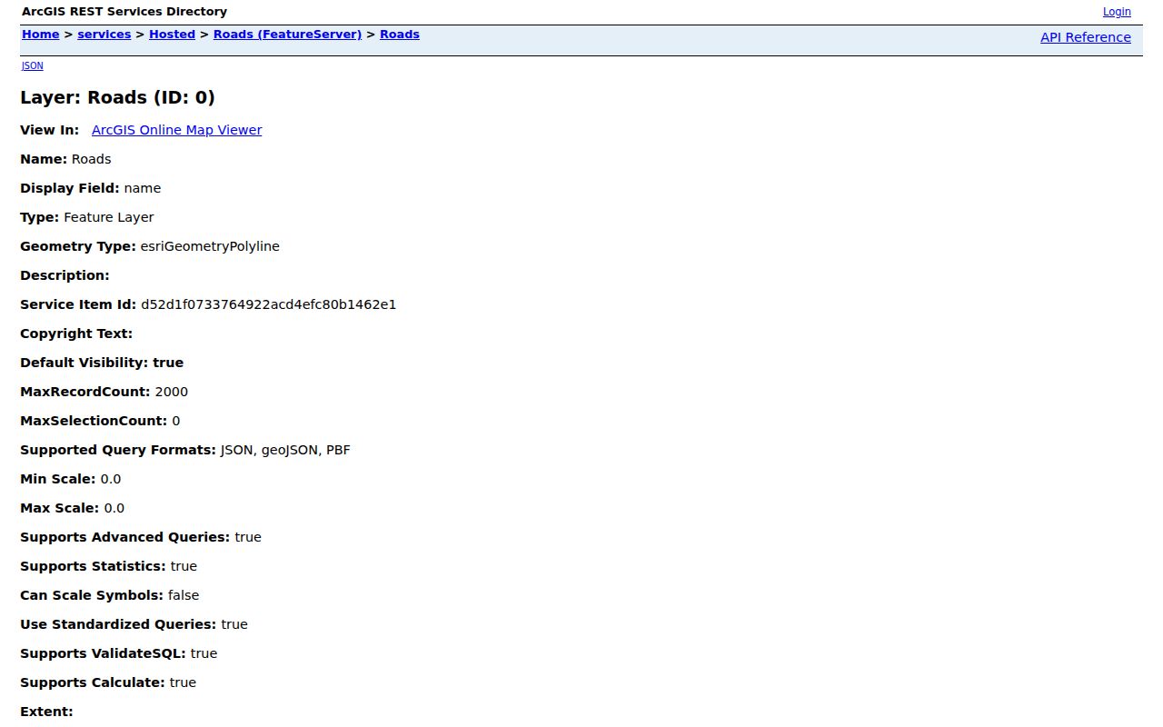
The road layer is a way to test a street spelling or range before moving to parcel and deed records. Check its altlabel field and a historic map or plat before declaring that a road was renamed.
The address-point layer first entered its present format on February 12, 2025 and is updated on a rolling basis. Municipal address layers are also available for Anthony, Hatch, Mesilla, and Sunland Park. The local government that keeps a permit, planning file, or municipal record depends on where the parcel lies, not on a familiar Las Cruces-style mailing label.
The separate E-911 service is also useful for a unit or street-range check because it carries direction, road type, source, unit, status, and created or edited fields. It is a structure-point layer, not a statement that a person lives at a point. When an address is in a city, compare the county parcel and road layers with the municipal address route before requesting local records.
Doña Ana County Street Directory Fields
The Assessor parcel service is an API-oriented public layer rather than a simple resident form. Its visible attributes can be filtered or read from a selected parcel, and none of the field filters is marked required. In the interactive viewer, search by the address, owner, account, or parcel only as the current viewer permits, then confirm the result in the parcel popup. The service supports pagination, order-by, and spatial queries, with a maximum of 2,000 records returned in a response.
| Parcel field | Use in a street search | Important limit |
|---|---|---|
| SITUSADDRS | Physical assessed property address | Does not name an occupant. |
| OWNERNAME / DEEDHOLDER | Owner or deed-holder clue for a Clerk search | Confirm in the recorded instrument. |
| ACCOUNTNUMBER | Ten-character assessment account | Assessment identifier, not a deed number. |
| PARCELNUMBER | Fifteen-character parcel identifier | Use with the mapped geometry and legal description. |
| LOT / BLOCK / SUBNAME | Bridge to a plat or subdivision record | May be more durable than a street label. |
| MAILADDR1/2 | Tax correspondence line | Never substitute it for a residence claim. |
These fields connect one street address to the property record without pretending that the map answers every people question. The service describes its data as assessment and location information. It also warns that it reflects a tax-year snapshot, so recorded splits, mergers, or adjustments can appear later than a deed.
- Parcel
- A mapped unit of property used by the County for assessment and legal geography.
- Situs address
- The physical location assigned to the assessed parcel, distinct from the tax-mail delivery address.
- Plat
- A recorded map that can identify subdivision lots, blocks, streets, and other legal-property details.
- Criss-cross directory
- A directory section arranged by address rather than by name, if the particular volume includes one.
Doña Ana County Street Records
Several public systems can be keyed to an address or parcel, but they answer different questions. The strongest modern pair is the Assessor parcel layer plus the Clerk’s recorded-documents index. Treasurer receipts add dated account and property context. Municipal permit or planning material can be useful once the correct municipality is known, although the inspected Las Cruces resources did not expose a stable public case search or a confirmed online coverage period. A narrow request should state the address, parcel or account, date span, and record type.
| Address-keyed source | County or local keeper | Record use | Access route |
|---|---|---|---|
| Parcel layer | County Assessor / GIS | Parcel, owner/deed-holder, situs, legal geography | Public map and REST service |
| Recorded instruments | Doña Ana County Clerk | Deeds, plats, liens, and instrument chain | Public Search, guest path, counter, or copy request |
| Tax receipts | County Treasurer | Account, legal description, dated tax context | Treasurer service; confirm current details with the office |
| Address and planning records | Municipality or county department | Request-specific permit or planning context | Department route or focused IPRA request |
| Historic maps | Library of Congress or library databases | Block and building context, not occupants | 1921 Las Cruces Sanborn map and library resources |
The New Mexico Inspection of Public Records Act is a fallback for an existing, nonexempt administrative record. It does not require an office to create a new report or override record-specific confidentiality and copy rules. The state IPRA request information explains the request route.
The County Clerk’s direct copy-request form is another documented channel when a search result identifies the needed instrument. It asks for the recorded name, approximate recording date, document type, certification choice, instrument number, book or page, and added details. A request with those identifiers is more likely to reach the right record than a broad request tied only to a street name.
Doña Ana County Street Deed Chain
For a property sequence, the street name is a starting label, not the durable key. Carry the account, parcel, and legal description into the Clerk’s current Advanced Search. Its tools include party names, separate grantor and grantee tokens, recorded and instrument-date ranges, document number, book and page, property address, subdivision or section legal fields, legal description, document type, party role, return address, status, and image or full-text choices. Results are refined around a 100-result display limit. The portal’s default start date is not proof that every historic record is digitized.
The Clerk’s Advanced Search supplies the field options shown in this source capture.
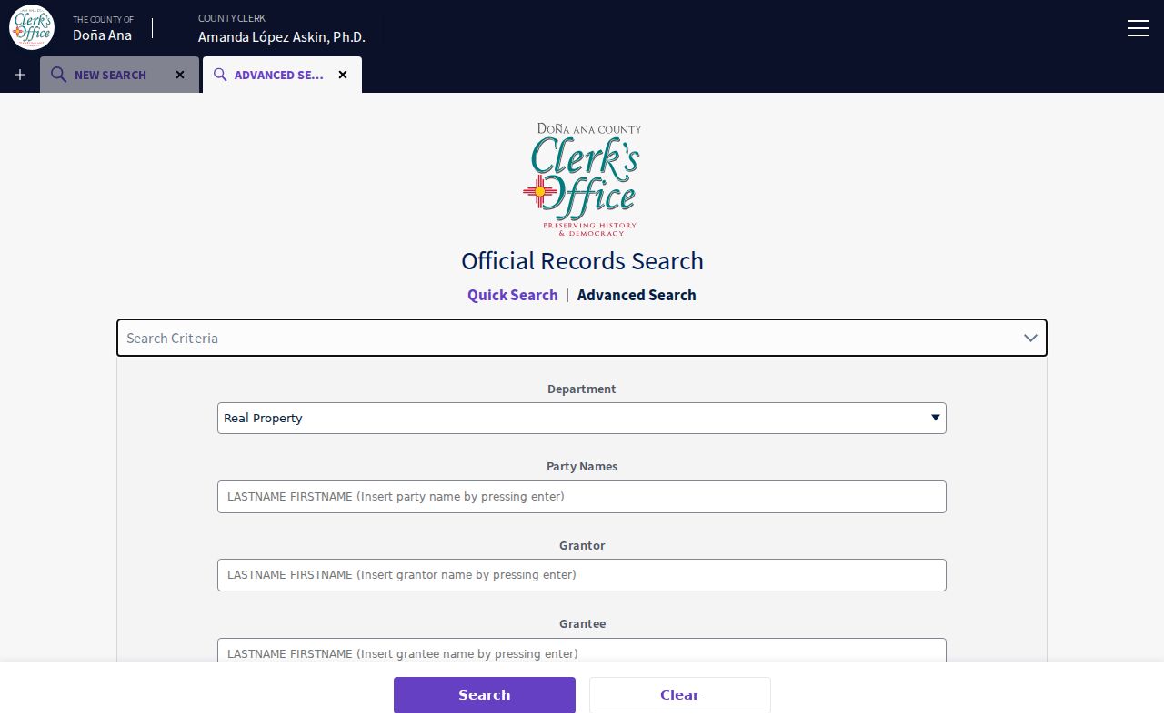
Read the source deed, not just the index line. Start with the current grantee-side instrument, copy its grantor, grantee, recording reference, and legal description, then search the seller as a prior grantee. When online images or coverage stop, the Clerk counter can locate older books, microfilm, or copies. The index itself is a finding aid and the Clerk instructs users to try spelling variants and review the source record.
Doña Ana County Street Geography
A street can cross a county parcel system, a municipal process, and a postal geography. Doña Ana County includes Anthony, Hatch, Las Cruces, Mesilla, and Sunland Park, along with many unincorporated communities. County Plan 2040 describes five incorporated municipalities and roughly sixty unincorporated communities. Before asking about a permit or a planning record, use the parcel and municipal-boundary layers to establish the address’s government jurisdiction. County deeds, assessment, tax, election, probate, and GIS trails remain countywide even when municipal records differ.
For a Las Cruces property, the City’s Building and Business Resources page links its address, GIS, parcel, zoning, and inspection routes. The source inspection did not find a public permit case index or a reliable coverage date. Ask the city records custodian for a defined record and time window rather than making a broad request for every file tied to an address.
Note: A postal city or a road label does not decide which office holds a municipal permit or planning record.
Historic Doña Ana County Streets
Historic address work requires geometry as well as names. The National Park Service describes historic Doña Ana village as a 35-foot grid of 137-square-foot lots that were later subdivided, beside the older linear settlement along El Camino Real. That local quirk can make a current street-string search fail even when a lot, subdivision, or land-grant description still points to the same property. The verified response is to preserve the legal description and map location, compare historic mapping with current GIS, and continue through the Clerk chain.
Sanborn editions identified for Las Cruces include 1893, 1902, 1908, 1913, 1921, and 1927, with the July 1921 edition directly digitized by the Library of Congress. A Sanborn sheet can date a building or show a block arrangement. It does not identify a person who lived there. For a dated published household lead, the local historical collections are treated separately in the Doña Ana County city directory.
Doña Ana County Street Limits
A street directory cannot establish every person who lives at an address. The parcel layer has no household-member, utility-customer, delivery-recipient, or unrecorded-occupant field. Driver-license address data are protected. The New Mexico voter screen requires a voter’s date of birth and is not a street browser, while public court summaries suppress address information. Safe at Home participants and protected-voter rules can also keep an address out of ordinary public access. A historical reverse directory, when one exists, remains a dated publisher association rather than a complete household record.
Absence from a displayed record is not a problem to work around. New Mexico Safe at Home gives eligible participants a substitute address, and the Secretary of State says confidential participant addresses are not released on voter lists. The appropriate response is to respect the limit and verify the information that an authorized custodian can lawfully provide.